About Us
Olkalou Constituency
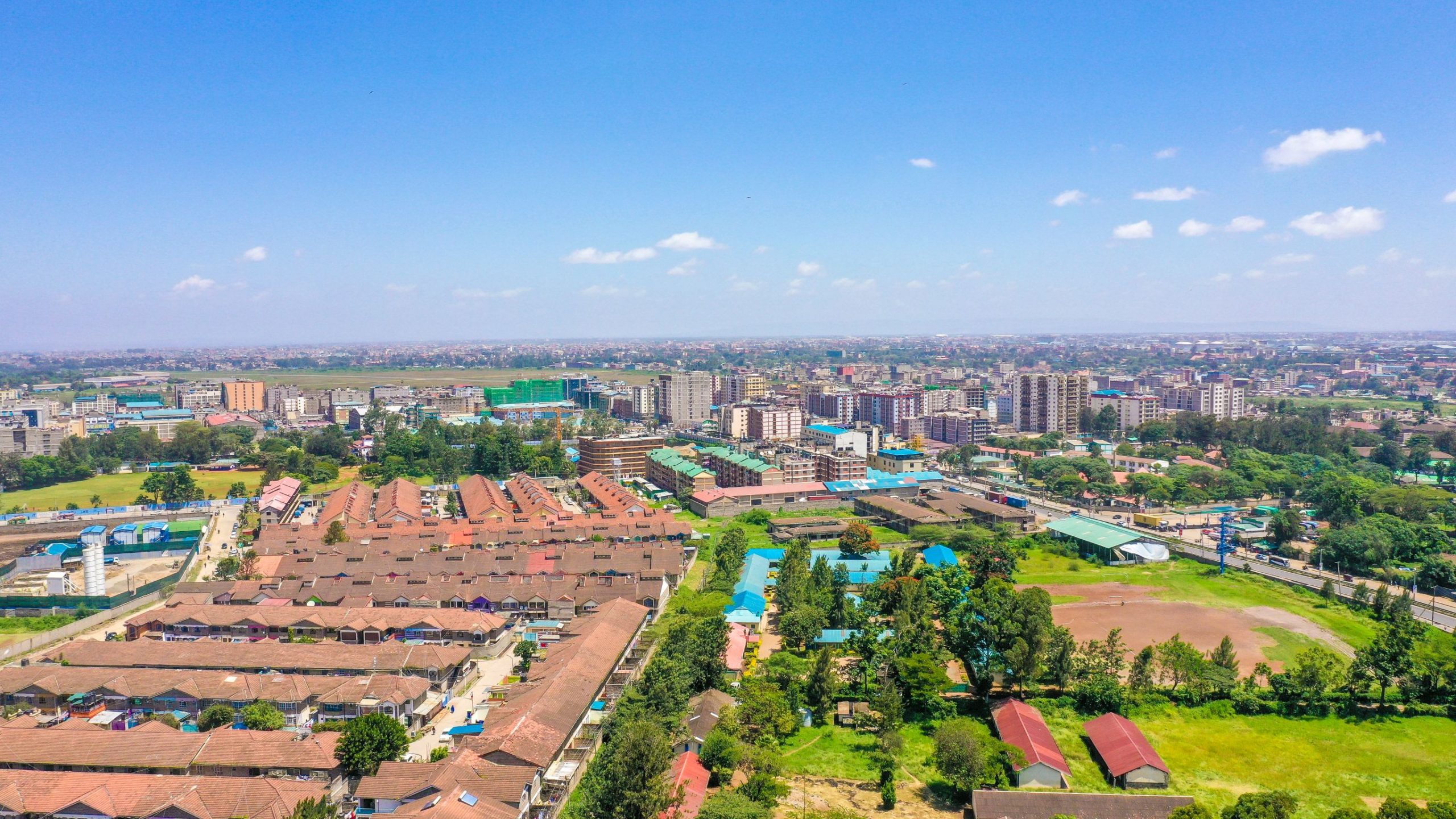
Starehe Constituency is an electoral constituency in Kenya. It is one of seventeen constituencies in Nairobi County. Starehe Constituency is constituency number 289 out of the 290 elective constituencies in Kenya situated in Nairobi County. The constituency is the host of Nairobi’s Central Business District(CBD) It is bordered by Mathare Constituency to the North, Kibra, Langata, and Dagoretti South to the South, Makadara and Kamukunji to the East and Westlands to the West. The constituency comprises of six wards The entire constituency is located within Nairobi City county area. The constituency is home of Nairobi Central Business hence it is an important pillar in the development of the county. It has the highest number of registered voters as compared to other constituencies in Nairobi City County. This is attributed to the fact that there is a higher workforce skewed in the central business district and environs as compared to other sub counties.
Currently the Member of Parliament of Starehe constituency is Hon. Charles Njagua Kanyi elected during the national general election held by IEBC on 8 August 2017.
Population
The population projection of the constituency is not very clear since the statistics provided by the KNBS is based on sub counties while administratively, Starehe Constituency in located in two sub-counties i.e. Starehe and Makadara. The Starehe Sub county population based on the 2019 Census is 210,423 with 69,389 Households with a land size of 20.6 square KM. The population density stands at an average of 10,215 persons per square kilometer.
The constituency has 166,397 registered voters as per the 2017 IEBC Voters register.
It has a large population settling in the informal settlements Commonly referred to as Slums. In South B Division for example, the Landmawe ward is largely dominated by informal settlements. This has brought a lot of challenges due to high levels of Poverty thus increased drug use and insecurity.
Economy
The constituency covers an area of 20.6 sq. Kilometers of which is purely buildings and markets. Starehe constituency has business as the major economic activity since it hosts the Central Business District. Due to high entrepreneurial existence of the residents, the day population is usually higher than the night population. Meaning most persons visit the constituency during the day but reside outside the constituency. Starehe constituency is a host of most of the Government offices and that too increases the day population.
On the same note, the constituency hosts several industries with the Nairobi Industrial area. That implies that the demand for semi-skilled and non-skilled labor is high.
Education
Starehe Constituency is a hub of most of the nationally recognized institutions like Starehe Boys Center, Pangani Girls and the famous Technical University of Kenya. In General, the constituency has 26 Primary schools and 14 Secondary schools, with no day mixed secondary school.
All the primary schools are highly populated with some schools having a high of 1800Pupils while the lowest has around 500 Pupils (Annex 1).
Security
The constituency is usually a beehive of activities during the day and during the night. Security forms a critical role in the in the economic activities of every country. Security therefore must form the center stage of development of very area more so an area which is urban in nature.
In Starehe, there are 4 major police stations, 1 prison, and approximately ten (10) Police post. Drugs and drug use has been a serious manage in Starehe and this has pushed the committee to make decisions geared towards mitigating drug use.
Access NG-CDF Information on your Mobile


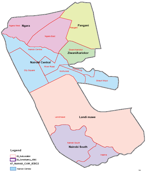
County Assembly Wards in Olkalou Constituency:
CENTRAL Ward
- County Assembly Ward No.:
- County Assembly Ward Name: CENTRAL
- County Assembly Ward Population (Approx.):
- County Assembly Ward Area In Sq. Km (Approx.):
- County Assembly Ward Description: comprises part of
KARIAKOR Ward
- County Assembly Ward No.:
- County Assembly Ward Name: KARIAKOR
- County Assembly Ward Population (Approx.):
- County Assembly Ward Area In Sq. Km (Approx.):
- County Assembly Ward Description: comprises part of
LANDIMAWE Ward
- County Assembly Ward No.:
- County Assembly Ward Name: LANDIMAWE
- County Assembly Ward Population (Approx.):
- County Assembly Ward Area In Sq. Km (Approx.):
- County Assembly Ward Description: comprises part of
NAIROBI SOUTH Ward
- County Assembly Ward No.:
- County Assembly Ward Name: NAIROBI SOUTH
- County Assembly Ward Population (Approx.):
- County Assembly Ward Area In Sq. Km (Approx.):
- County Assembly Ward Description: comprises part of
NGARA Ward
- County Assembly Ward No.:
- County Assembly Ward Name: NGARA
- County Assembly Ward Population (Approx.):
- County Assembly Ward Area In Sq. Km (Approx.):
- County Assembly Ward Description: comprises part of
PANGANI Ward
- County Assembly Ward No.:
- County Assembly Ward Name: PANGANI
- County Assembly Ward Population (Approx.):
- County Assembly Ward Area In Sq. Km (Approx.):
- County Assembly Ward Description: comprises part of